GS 1: Geography of Himachal Pradesh: Relief,drainage, Vegetation Cover and Types
✓Himachal literally means “Land of Snowy Mountains”
✓The state of Himachal Pradesh popularly called
A) ‘Abode of Gods’
B) Devbhoomi
C) The Fruit bowl of India
D) The Apple State of India
E) Nature’s Paradise
✓ It is nestled in the Western Himalayas between 30’22’to 33’12’ North latitude and 75°47′ to 79°04′ East longitude.
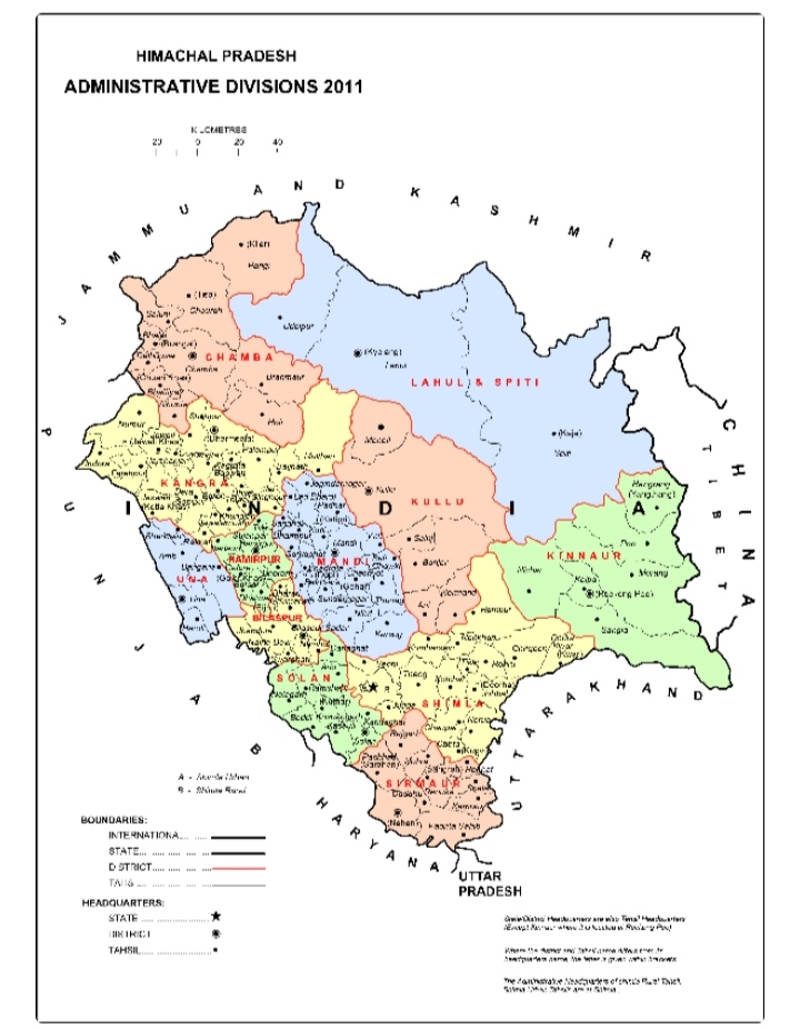
✓ To the East it makes India’s border with Tibet. To the North lies the State of Jammu & Kashmir.Punjab to the West. Uttrakhand and Uttar Pradesh to the South-East and Haryana to the South-West.
✓Spread over an area of 55,673 Sqkm, the territory of Himachal Pradesh is mountainous with altitude varying from 350 m (1,150 ft) to 7000m (22,965 ft) above the sea level.
✓ There is general increase in elevation from West to East and from South to North.
✓The geographical area of Himachal Pradesh (55,673Sqkm) acconts for 1.7%of the total area of India (3,287,263 Sqkm).
✓Out of this total area, 45,318 square kilometres is the measured area according to the revenue papers.
✓In terms of area Himachal Pradesh is the 18th State of India.
✓As per a study conducted in 2009 by the Centre for Geo-Informatics, Research & Training of the Chaudhary Sarvan Kumar H.P. Agriculture University, Palampur for estimating 3D area of the State by using modern Geo-IT tools, remote sensing and GIS, the 3 D area of the State comes to 86,384.77 sq. kms which is about 56 % more than the 2 D area of 55,673 sq. kms,
✓HP shares international border with China. Length of international border with China is 345 Km.
✓It is watered by a number of rivers namely – Chenab, Ravi, Beas, Sutlej and Yamuna.
✓Lahaul and Spiti district of Himachal Pradesh is largest by area. Kangra district is largest by population.
MAP OF H.P SHOWING BORDER WITH UP,J&K, PUNJAB,HARYANA,Uttrakhand👇
